Rampart Range Road

Rampart Range Road and Pike National Forest administered and maintained by the dedicated people of the

United States Forestry Service.


Rampart Range Road


Situated in the Pike National Forest, Rampart Range Road was built during the Great Depression of the 1930's by the Civil Conservation Corps . Along with projects like the WPA and the PWA, the CCC was a brainchild of President Franklin Delano Roosevelt to help cure the economic woes of our nation. It's purpose was to provide employment to those who could not find work in the disabled private business sector. It is a monument to men who bivouacked in tents for months and faced the elements and nature to build a road that still is in use today by local residents and tourists alike.

Rampart Range Road begins in Garden Of The Gods in the city of Colorado Springs, Colorado and snakes a path some 60 miles in a northerly direction ending at Highway 67 between Sedalia and Deckers. There are absolutely no services along Rampart Range Road and very few "exits" along the way. The first chance actually off the road is a turn into Woodland Park and makes a wonderful one day nice slow day to stop, hike, picnic, photograph, or just drive some of the backroads that provide camping areas for overnight stays. There is another "exit" near Monument CO, just behind the United States Air Force Academy. Of course, the 60 mile road can be easily completed in a day, but this is a time to stop and smell the roses and enjoy your time alone with nature.

The quality of the road varies but all is traversable by automobile and a four-wheel drive vehicle is not necessary. However, if you own a four-wheeler or a dirt bike, you will find an abundance of challenging trails to enjoy and test your mettle. The first three miles starting from Garden Of The Gods is part of the park area and the next 2 miles are still part of the Colorado Springs city limits and the road is not kept up at all. Go slow...rocks abound as the road is not get graded often. After about 8 miles, begin to rest easy, the road smoothes out and the front end suspension of your car will thank you for the rest.

There are 2 round "water towers" along the way. The first is near the edge of the city limits and a wonderful place to stop as well as a great photo op of the front range. An older lady I worked with many years ago told me of remembering there being a consession stand and picnic tables there in the late 30's and early 40's and topo maps today still show the tables, although I assure you they are not there now. About 9 miles up the road is the second water tower and just beyond that a very nice shooting range. Besides the shooting areas labeled as such, the discharge of firearms is prohibited along Rampart Range Road so keep your six-gun in your holster, Pardner.
I personally think of the area between Garden Of The Gods and the Woodland park exit as the "first stretch" and I devide them this way. The "first stretch" is the most majestic with fabulous views of Pikes Peak, beautiful valleys, tall aspens, aromatic pines and evergreens. In this "first stretch", the young men with CCC built a wonderful point at the "summit" of this first loop. There are two observation points about a quarter a mile apart. The first, the most southerly, is so close to the face of Pikes Peak that you feel you can nearly touch it. I have checked a topographic map and by my crude measurements this observation point is about 6 miles as the crow flies from the face of one of the most famous mountains in the world. The elevation is about 9250 feet at this point and no matter how calm the winds anywhere else on Rampart Range Road, they always whip through this pass. Below the peak is Ute Pass and the towns of Cascade, Chipeta Park, and Green Mountain Falls with the rides at the North Pole (a children's amusement park situated at the entrance of the Pikes Peak Highway) adding manmade color to the view. To the south (your left when you are facing the Peak), the cities of Colorado Springs and Manitou Springs and beyond Pueblo to the Sangre De Cristo mountains are visible. To the north, the mountains of Rocky Mountain National Park shimmer. The view and the feeling of the expanse of nature is absolutely awesome. It's a panarama of epic porportions. I've always said this is most likely God's summer home. Further down the road is a lovely rock wall with another view of pikes peak and a bronze completion and dedication plaque dated 1933.

It is past the point of the observation areas that the majority of off road excursions become abundant. Watch each side and if you see a chance, turn. If it looks like you can easily enter the road with the vehicle you are driving then by all means go for it. Although a lot of them are very narrow, most are easily attainable in an ordinary family car. Drive carefully and watch for low areas in the road ahead for water. Many of the low areas are lower than they look, don't get stuck. I got stuck once and was very lucky. I found a towtruck for only sixty five bucks. It can go as high as a hundred bucks and more if you are crazy enough to get stuck on the road in the winter snows. The road is rich with places that have been used many times for camping, complete with firepits made from rocks and nice flat places to park a tent for the night. The view will range from deep forest woods to a mountain meadow with Pikes Peak in the background. A walk in the woods from these offroads can be romantic for a loving couple or a chance to feel one with nature and a chance to be alone with oneself. I have experienced both, and each is its own pure blessing.

Farther to the north but before the Woodland Park turn off is Rampart Reservoir. A right turn and the road turns paved and progresses past camping and picnic grounds and to the reservoir its self. Drive across the dam and the view is breathtaking. It DOES cost per car to enter the area there but it is worth it. The fishing is good and the camping areas great and well kept. Back to Rampart Range Road, heading towards Woodland Park, the road passes through a beautiful meadow. On the left side, a expansive view of Pikes Peak and the front range. On a clear day you can see beyond Denver. A couple of miles and a road crosses with a cinderblock house on the northwest corner. A left here will wind down a paved road into Woodland Park and back to Colorado Springs. A right will take you on a very rough road to a water tower. Trust me, take the left turn.

The road beyond the Woodland Park turnoff is less majestic and more peaceful in my opinion. The topography of the land changes suddenly after passing that simple intersection. Still, many off road adventures await, and the backroads go farther into the forest. The terrain flattens some and there is more area to explore by car and by foot. Further down the road is Orme's Peak and below that out of sight is the United States Air Force Academy and just beyond that a turnoff to the town of Monument on I-25. Taking that turn-off will return you to Monument and the interstate for a southern trip back to Colorado Springs or a northern route to Denver.

Beyond the Monument turn-off is Devil's Head. Devil's Head provides a wonderful hiking trail of easy to moderate difficulty with the prize at the end of the trail being a real honest-to-goodness forest fire lookout tower. I'm not sure if it is still staffed by a park ranger at this writing but was a couple of years ago to the best of my knowledge. It's well worth the climb and a real "photo op".

I will admit to not remembering the balance of the trip as it has been a few years since I passed that way, but I do remember the beauty of the timber, the singing of the wind rustling the leaves, and the absolute quiet, a rare commodity in the city. Suddenly, assault from a stop sign and it's time to turn right on a normal paved county road and wind toward the interstate. Denver is so close you can almost smell the pollution and Colorado Springs is a short hop on I-25.

As with any trip to the backroads where altitude reaches 8000 feet or higher, there are a few essentials you want to make sure you have with you, even if you are planning only an afternoon outing. You know the old saying about "the best laid plans". Trust me on this, a couple of rolls of toilet tissue are the FIRST thing you pack! A bar of soap and a washrag should go in a plastic dishpan as a set. Take warm clothes, coats, hats, gloves. Even in summer the temperature CAN drop to hypothermic temperatures at night. Children especially need protection from the cold. A disabled auto is no heater at all. Take some extra food, water, and any medications you may need to take that day or the next. A good flashlight is worth it's weight in gold. You can not believe how dark it can get that far from "civilization". So you don't smoke, buy a disposable lighter anyway and throw it in the glove compartment along with a first aid kit. Lots of deadwood to make a fire is useless if you can't get it started burning. Take extra water for putting out your campfire unless you have a shovel you can use to cover your fire completely with dirt.

Taking the family pet? Hey, they gotta eat and drink too. Take extra water for them as well as a couple of cans of pet food. I buy 2 cans of dog food each spring and throw them in the trunk. If I don't use them by next spring, I throw them out and buy 2 more. A couple of bucks is pretty cheap insurance for your pet's health. Do NOT take flares. This not the ocean, you are not on the Titanic, you are in a national forest. Fire danger and all that. If you are in real trouble and need some help, your car horn will attract attention.

And on the subject of fires.......
Before going on your little excursion in the summer, call the local Forestry office (in Colorado Springs contact Pike Peak Ranger District, 601 South Weber {719} 636-1602) and ask about the fire danger and any restrictions on open fires. Often by late June or July, there has been little rainfall in the forest and the timber is bone dry. An open fire in violation of restrictions will net you a hefty fine and a real bad eye from fellow campers. "Ignorance of the law is no excuse". You don't want to die in a forest fire and I want a place to go next summer.

Take a large trashbag and PACK OUT YOUR TRASH when you leave. Tie the trash bag to a tree limb and fill it like you do at home. Besides my own trash, I've packed out everything from dirty diapers to TV dinner trays. I really am tired of it. Try not to take glass containers. Dropped on a rock they tend to shatter and make the ground around dangerous to walk barefoot. (What kid doesn't wanna walk barefoot?) Pack along a kitchen fire extinguisher (labeled for "ABC" fires). Trees, unlike carpets and holloween costumes, are not coated in flame retardant. If a cigarette butt can start a killer forest fire, imagine a campfire gone wild. The last thing you want is your car, your tent, you or your family downwind from a spreading fire.

The opportunity to get back to the wilderness of our forefathers who settled this area carries with it responsibilities to the land and to the next person that travels that path. Enjoy both the experience and the responsibility.

If you do the things I mention, and the things you remember that I forgot, you will have a safe, happy adventure that you won't soon forget. After your excursion, drop back here and leave me mail and let me know what you thought.


Click on the small images below to see them full screen

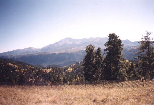
This is a view of the main road with Pikes Peak in the background. In nearly all places, it's at least 2 lanes wide. However, there are lots and lots of "blind curves" and I've gotten in the habit of just tapping my horn to alert oncoming cars of my approach.
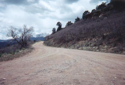
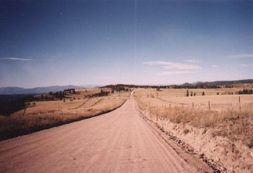
This photo was taken in early Spring 4 miles from the Garden Of The Gods entrance to Rampart Range Road.


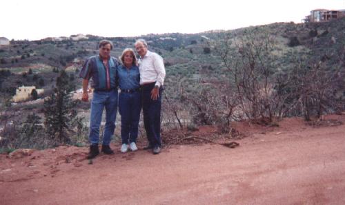
Photographer and friends taken just inside the Colorado Springs city limits by someone traveling the road. Just below where this picture was taken is Cedar Heights, an exclusive housing development.
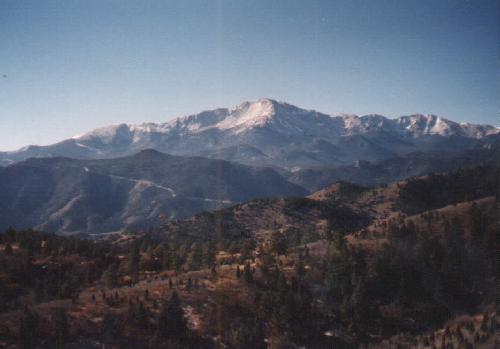
Taken at the first water tower about 6 miles up the road showing part of Cedar Heights below Pikes Peak.
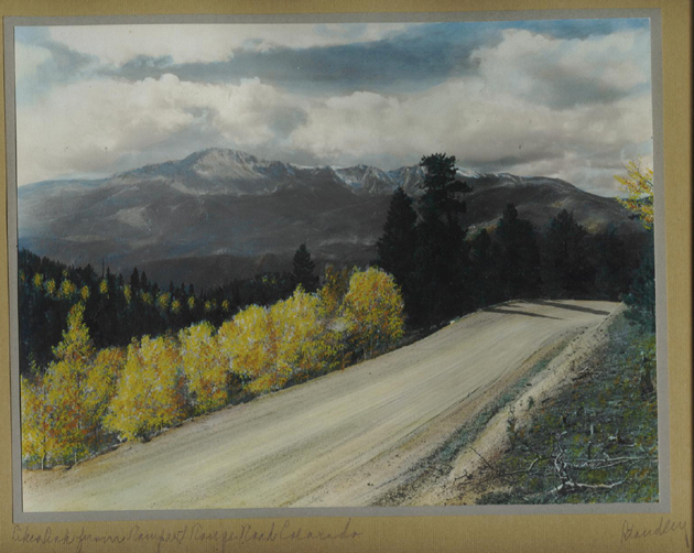
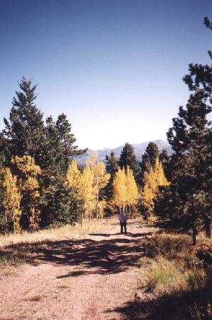


This is one of the better and most traversable side roads with the photographer's wife in the background. This picture was taken in October, 1998 during the changing of the aspen leaves. For even more images of this spectular event, click here.

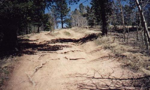
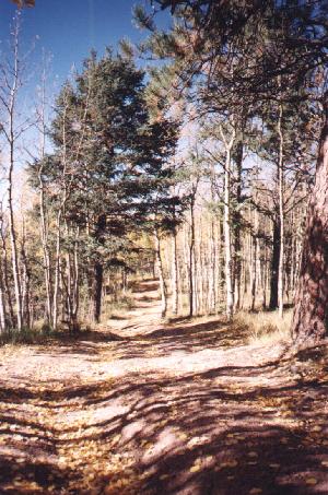
Once off the main road, a myrid of paths are available to hike back into the forest. It is advisable, however, to mark your trail. Trust me, all the trees begin to look alike and it's easy to get lost. (Been there, done that...sigh.)


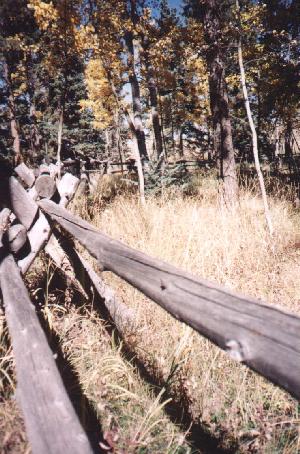
Hand made rail fences like this one dot Rampart Range Road. However, there are also some areas that are private property and marked with wire fences and no trespassing signs. There are acres and acres of public land to hike, please respect those signs.


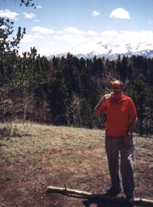
The photographer relaxes at the "first summit" in this picture taken by his wife. The line on the mountainside in the right center is the Pikes Pikes Highway.
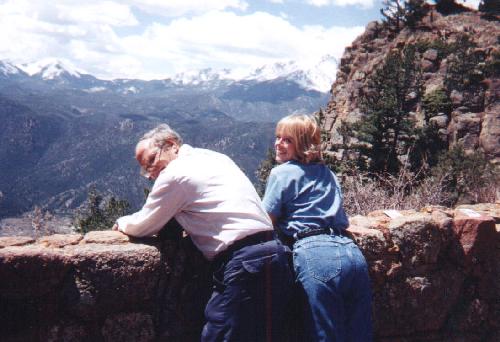
The photographer and a very special friend enjoy the view from the walled summit overlook in this photo taken by her husband.


Another photo on the wall, this one of a beautiful lady.
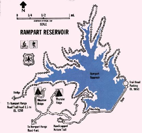


Map of Rampart Reservoir, well worth your time and the minimal expense.
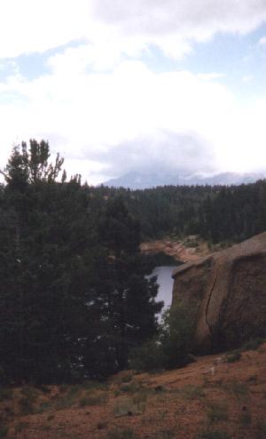


This photo was taken just before a July afternoon rainstorm at the Rampart Reservoir in one of the picnic areas.
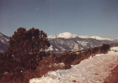
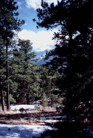


Just beyond Rampart Reservoir, Pikes Peak snows shine between the pines in the afternoon April sunshine.


This portion of Rampart Range Road, the "meadow" as I call it, is just a few miles from the Woodland Park exit and is very well maintained.
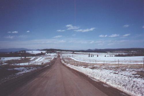
This photo of the the road above was taken in early April and is very well maintained. There are some residences and city maintained areas accessed off this stretch and is often plowed during the winter snows.

The view from the "meadow" area. Notice the snowfence in the foreground.


This photo in the same location as the image above, was taken in early April following a major blizzard just a week before.

This is the view of the mountain meadow facing opposite the photo above.


If you desire to enter Rampart Range Road from the Woodland Park access and find the best camping areas or go to directly to Rampart Reservoir turn on Baldwin Road at the McDonalds as you enter Woodland Park from Colorado Springs. Follow the signs in the photos below. (This also an excellent way to visit Rampart Range Road north the Woodland Park turnoff.)

At this sign, take a right turn on a nicely paved beautiful winding road.
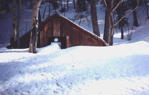


This small barn is nearly covered in April snow.


At the stop sign, follow this sign to the right. (A turn left continues the road to Devil's Head, Sadalia, and it's eventual end.)


A Sunday afternoon picnic, mid April, 1 mile south of Rampart Reservoir

This side road leads to a most beautiful camping/picnic area with a perfect view of Pikes Peak.


Even as late as June, snow can be found in the shady areas. The photographer's dog, Coolie, hits the powder!


Most back areas have been visited before and often you will find extra gathered firewood, a rock fire pit and even the perfect log for everyone to sit on. This was the perfect picnic area!
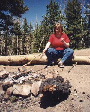
The photographer's daughter roasts a special hotdog over the perfect fire and it becomes......


The best damn hotdog ever!


The outhouse is as big as all outdoors. Ladies room is first pinetree to the right. Men to the left, please.


This photo is a very special treat sent to me by RRR lover Jerry in Vista CA of an original Harry Standley photo he owns. Harry Standley was a local/state photographer near the turn of the century and photographed much of Colorado, then hand tinted his b/w photos to sell in local tourist shops. There is a lot of good info on Harry on the Web including photos for sale, and looking as hard as I could, I found no other images on the net of the photo reproduced here. Thank you Jerry for the wonderful opportunity to display this beautiful and valuable print.


All these photos were taken in the area between Colorado Springs and Woodland Park. This summer I plan to take another two days and see the entire route again. Have no fear, I will share more words and images here when I return. At this writing, March 24, 1998, there is too much snow to make it. June. Yeah June. Pardon while I go mark my calendar.

Editorial comment

A note about the good people that travel Rampart Range Road:

There is not a 7-11 around the corner.
There is not a pay-phone hanging on any tree.
There is not a farm house to stop and ask for directions.
There are only your fellow nature or backroad lovers.
If you get lost (which is pretty hard to do on a road with almost no turns), or experience car trouble, or need medical assistance, don't hesitate to stop someone and ask for help. I've flagged down many a car or truck and been flagged myself. The one time I got seriously stuck, two young men worked for 2 hours trying to get me out and finally took us home (right to our door). Stopping to take a picture is likely to garner 3 or 4 people slowing to make sure you arn't having car trouble.
Smile, wave, and say thanks. These are good people.


Your comments are appreciated. Please send me e-mail and let me know how you liked this site.

If you liked this webpage, you may enjoy others I have done.

Some beautiful Currier & Ives prints.
The beautiful fall changing of the Colorado aspen leaves.
Colorado Springs' March, 1988 blizzard.
Some of my favorite poems and quotes of Robert Frost.

Map of Rampart Reservoir taken from Front Range Cycling Page.
Image at top of page is the official symbol of the United States Forestry Service (USFS)

Photos and text © 1987 and 1988 by Ronald Krob.
Permission is extended to use any text or images for your notfor-profit web page provided you either credit the photograher/writer (Ronald Krob, Colorado Springs, CO) or provide a link to this page (http://www.pcisys.net/~ronkrob/rampart.htm) Note: The Harry Standley photo displayed is assumed to be in the public domain for display on this not-for-profit site. The photo is not offered for sale, lease, or transfer of the image. The use of this image was authorized by the owner of the original photo, however, I assume full responsibility for it's display here. If you know of any reason that the display of this photo violates any copywrite laws, please e-mail me immediately with any proof and the photo will be withdrawn from this site. R.K.

(I sat here at midnight trying to remember the name of one little town in the Ute Pass area. My wife couldn't think of it, I couldn't remember, and I knew I wouldn't sleep without knowing. When I was a kid, our family vacationed and went horseback riding there. I've driven through it a hundred times in my 16 years here. All this I could rememer, everything but the name. My thanks to the dispatcher at the El Paso County Sheriff's office for giving me the name Chipeta Park and a good night's sleep. These guys do a lot more for the community than run around giving traffic tickets.)

FastCounter by LinkExchange