|
|||
Home | The Diary | Commentary | Credits | Links | Text Files |
|||
April 12, 1945President [Roosevelt] died. We packed everything that we were going to take with us. Johnny and the other boys shipped out in the morning.
Friday, April 13, 1945Shipped out of Fort Ord for San Francisco. Got on board ship. It sailed at 7 P.M. P.W.T. [Pacific War Time] Found that the boys were also aboard. President Roosevelt instituted year-round Daylight Savings Time, called War Time, on 9 February 1942.
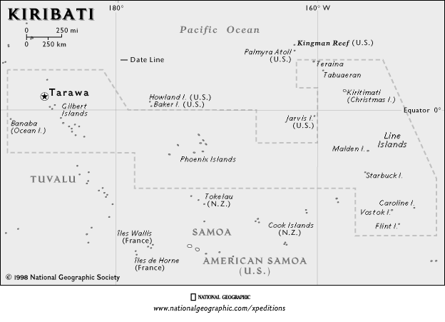
Sunday, April 22, 1945Crossed equator at 7 A.M. in the morning. Crossed it close to Baker Island but didn't see it. Haven't seen land since we set sail from Calif. Since the ship crossed the International Date Line one day later, it must have crossed the equator due east of Baker Island, a tiny uninhabited atoll in the mid-Pacific at 0.195ºN, 176.48ºW. Baker Island lies 4291 miles from San Francisco, on bearing 246º, and 1975 miles from Hilo, Hawaii, on bearing 230º. It is slightly east of the Gilbert Islands. For an overview of the Pacific Theater see Pacific Naval Battles, Pacific War Timeline, and Hyperwar: World War II: Pacific Theater of Operations. Sunday, April 23, 1945 [Monday, April 23, 1945]Today is Sunday again - we crossed the international date line - two Sundays in a row. [date and entry crossed out] untrue rumor.
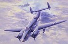
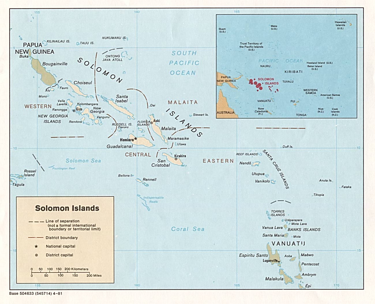
Tuesday, April 24, 1945 [Wednesday, April 25, 1945]Crossed the internatl date line last nite so there is no April 24th - it's now Wed [April 25]. We skipped from Monday to Wed - no Tuesday. The time change when crossing the International Date Line can be confusing. Friday, April 27thSaw land for the first time in 13 days - we now know where we're at. We passed between Guadalcanal and San Cristobol [San Cristobal] Islands in the Solomon Group. We're now in the Coral Sea. Coral Sea is rougher than the mid Pacific - the ship is really pitching probably due to nearness of land. A Lockheed Vega patrol bomber picked us up off Guadalcanal. It swooped down so close you could touch it with a broom. Our blinkers identified us as a friendly ship.
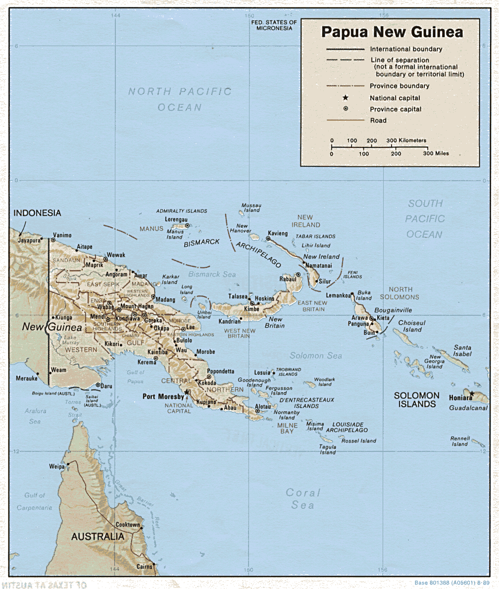
Sunday, April 29thPassed New Britain Is. and then went into Finchaven [Finschhafen], New Guinea - didn't even stop - got instructions from shore by blinker and changed course. Finschhafen is on the east coast of Papua New Guinea, due east of Lae on the Nugidu Peninsula. Dad told me that he remembered sailing close to New Guinea. He said that none of the GIs knew whether this was their destination. When he saw the thick jungle growth, he was scared and thought, "It would be hell to live and fight in this." The ship sailed on. Monday, April 30Steaming toward the Admiralty Isles which are on the horizon. Since we left Finchaven [Finschhafen] yesterday have been passing all kinds of unidentified islands. Most of them mountainous with peaks sticking up into clouds. Just peaks stickin out of water.
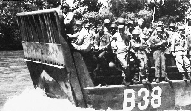
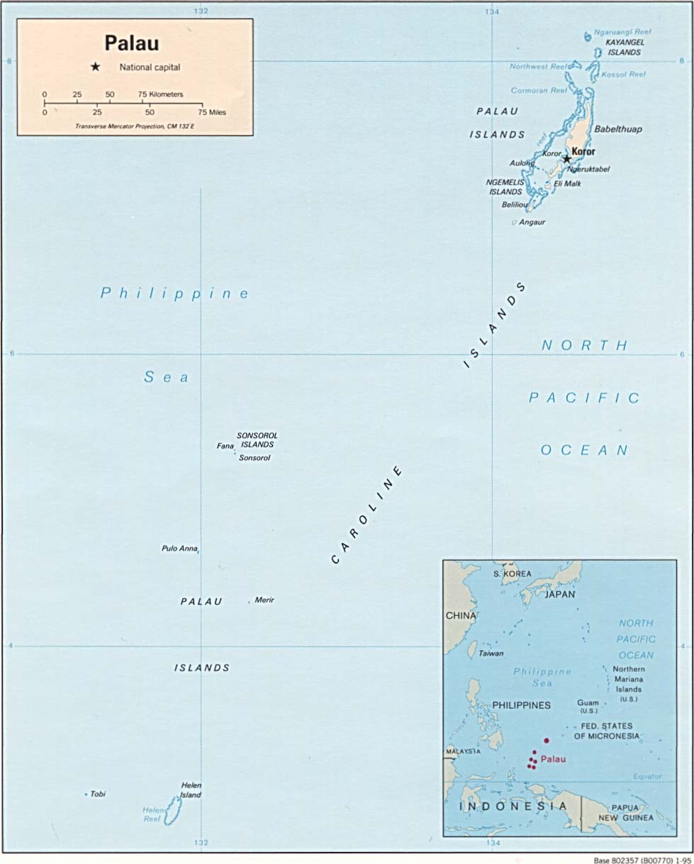
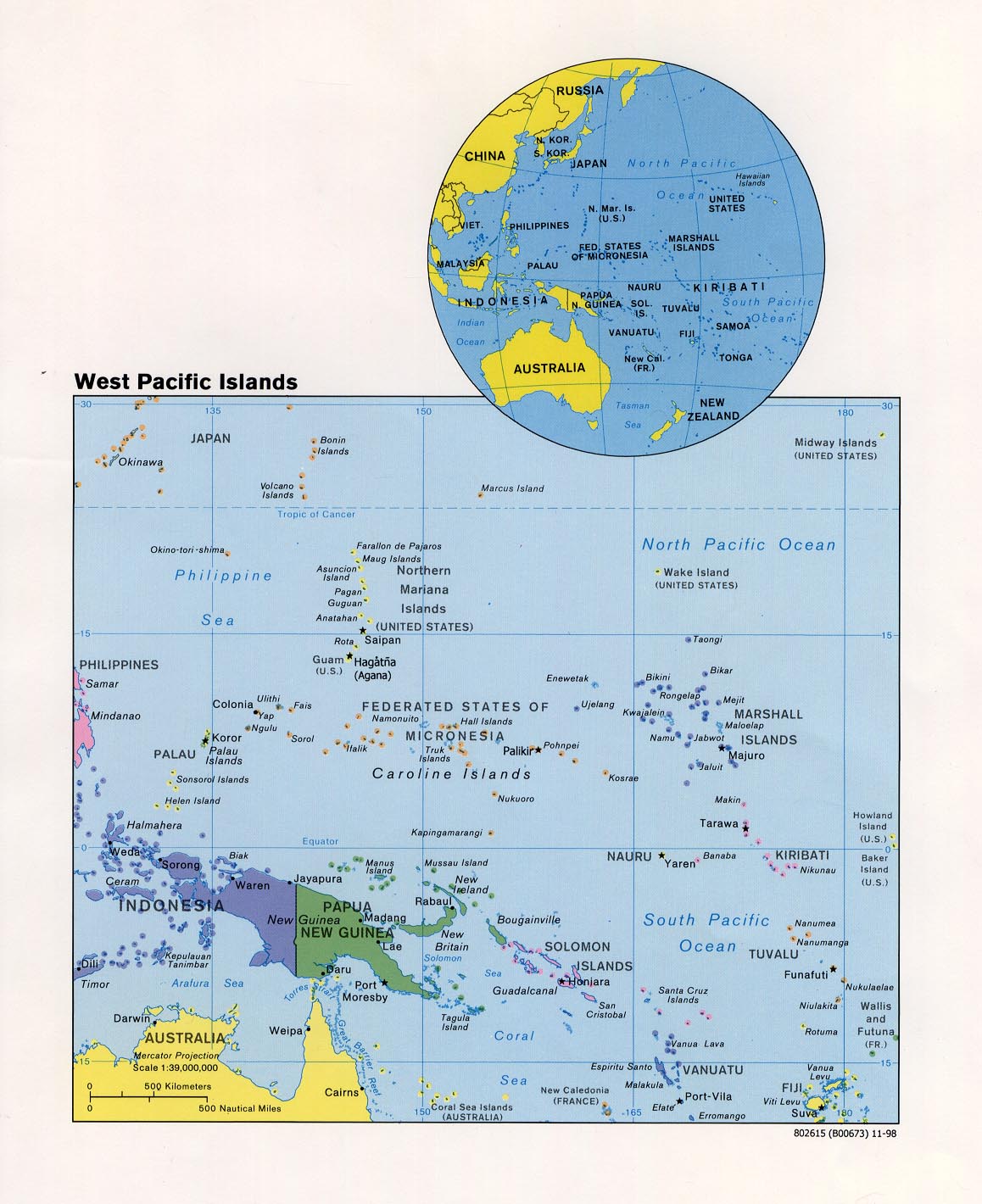
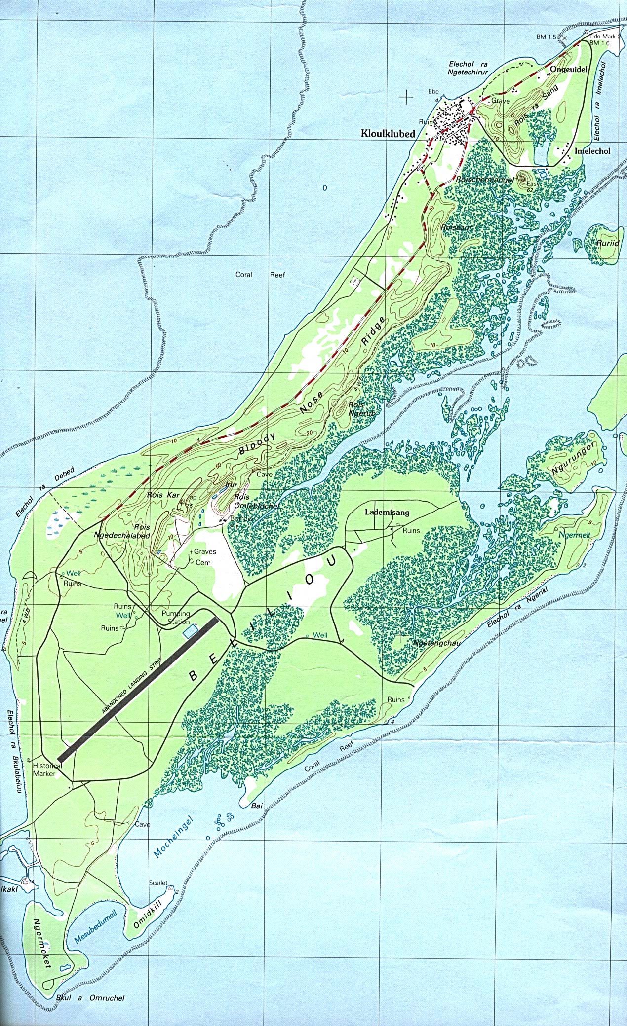
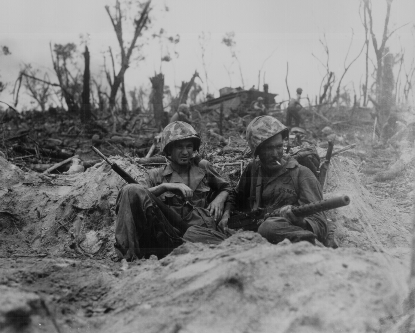
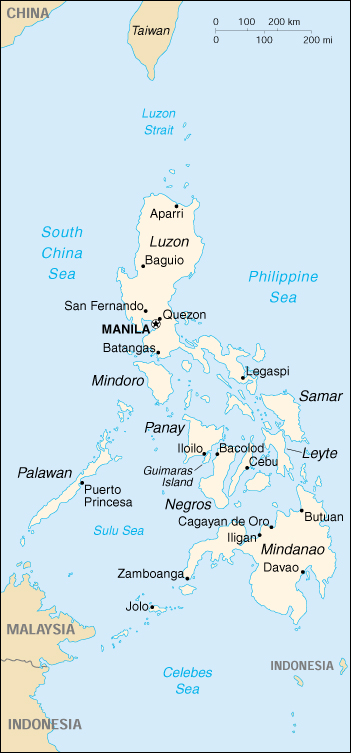
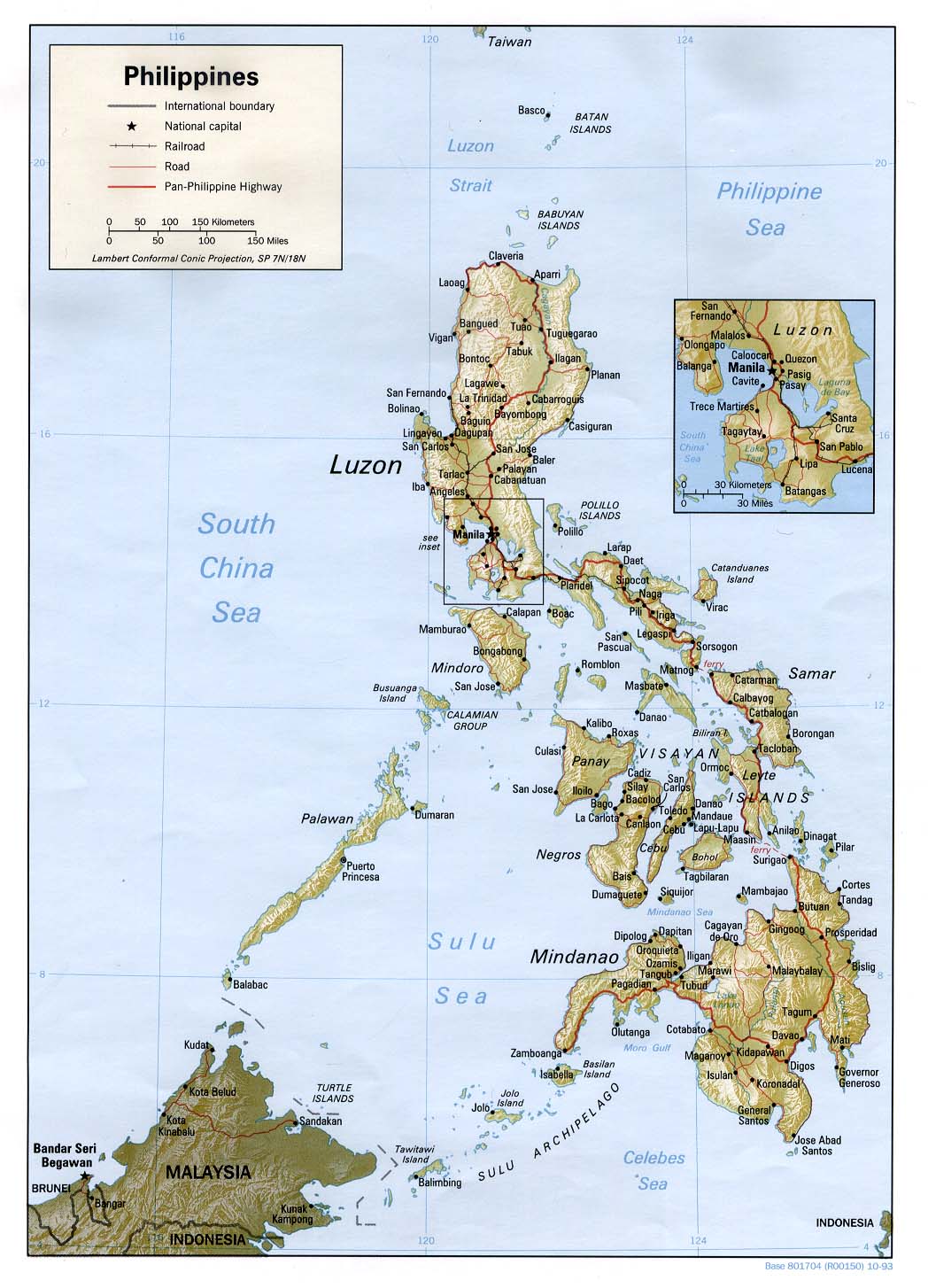
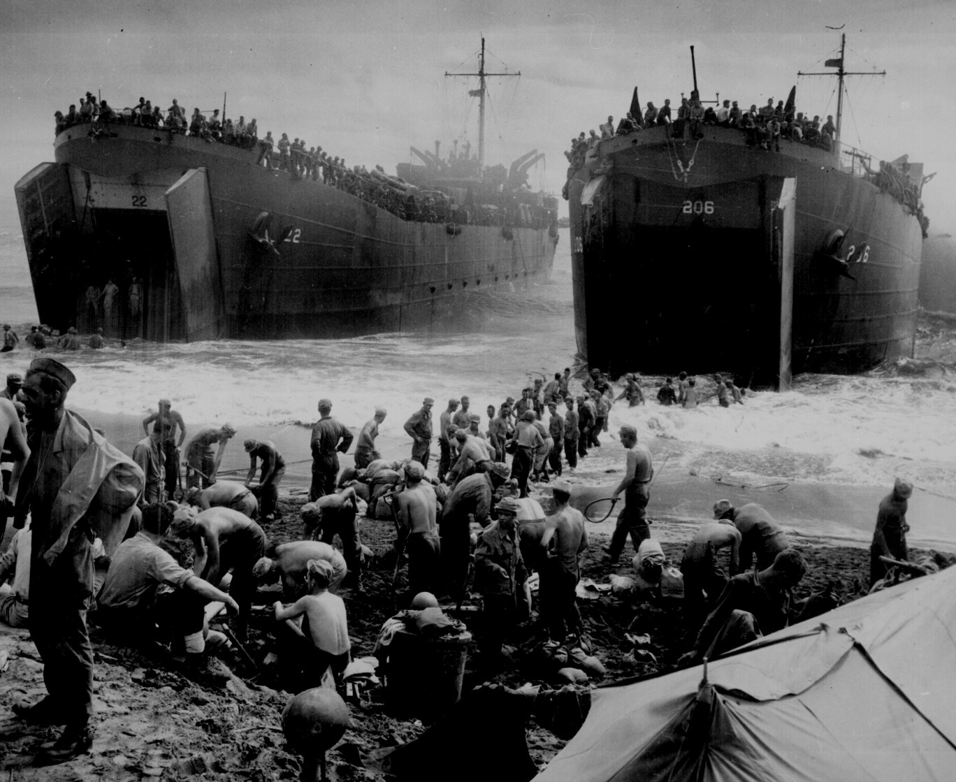
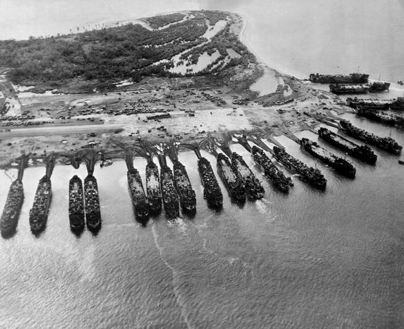
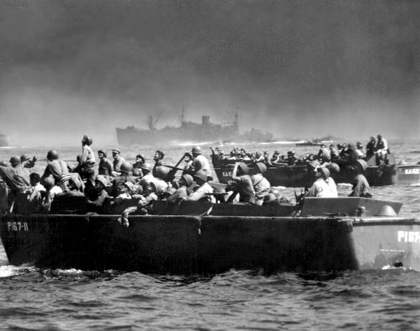
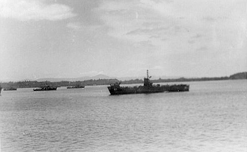
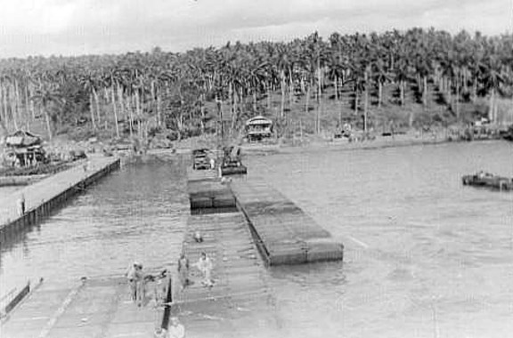
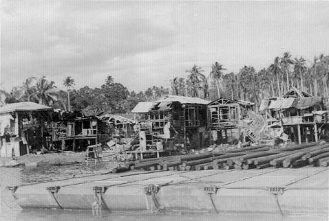
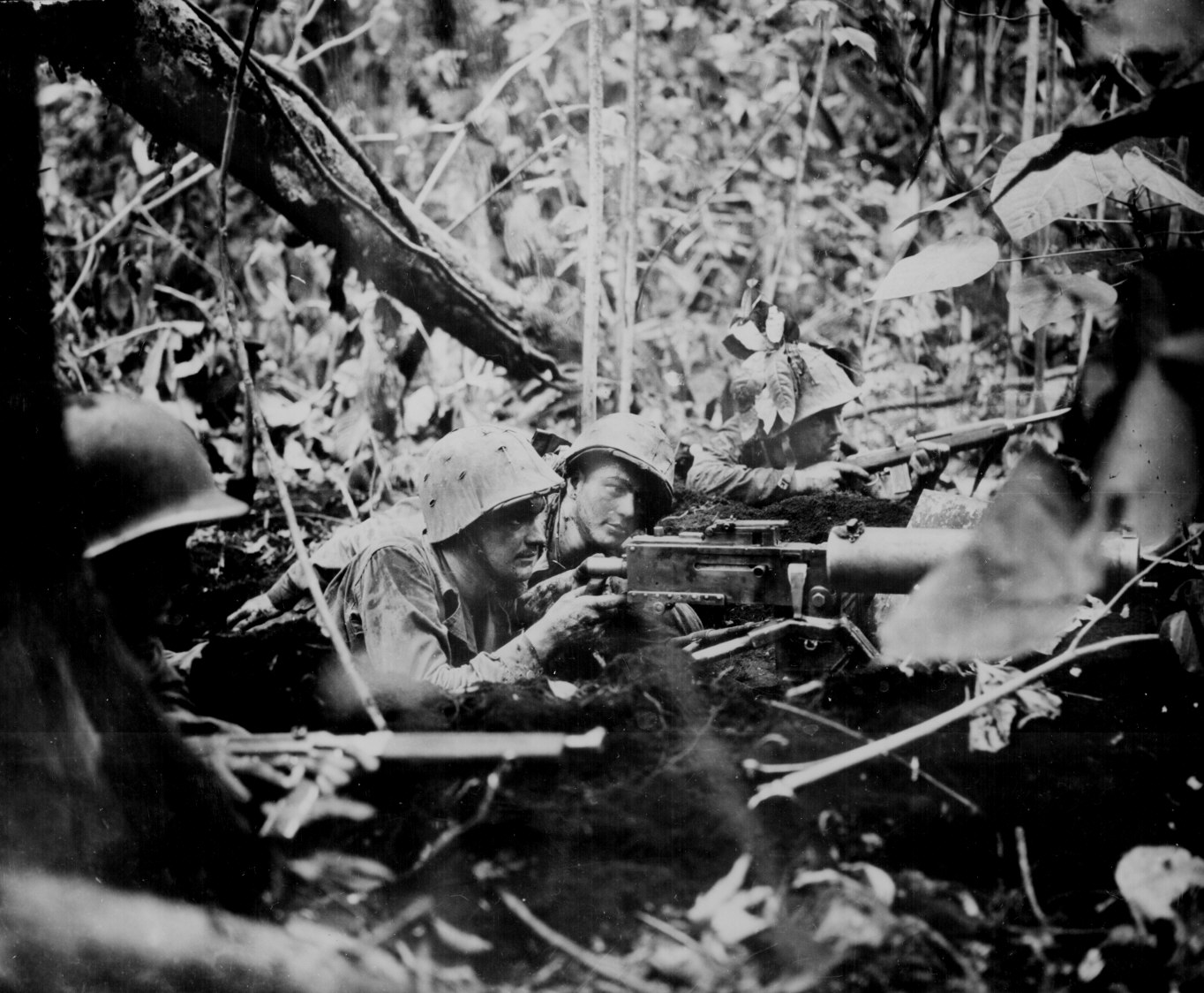
May 2, 1945Arrived at an unidentified harbor in the Carolinas (near Palau). 20 or more ships anchored here. ["Carolinas" is crossed out. "Pelielieu Is" and "Palau, Is." are written in blue ink in the margin.] This was Peleliu, also known as Beliliou Island, in the Palau Islands, west of the Caroline Islands, and about 500 miles due east of Mindanao. Here is a Map of the West Pacific Islands and a Map of Peleliu. The U.S. Marines invaded Peleliu on 15 September 1944. Here is a photo of two Marines who fought in the battle. (National Archives) May 3, 1945Left harbor - convoy of 7 ships and two DE's [Destroyer Escorts]. Sister ship to ours in convoy. Several tankers and some merchantmen. One DE dropped ash cans [depth charges] at about 6 PM - sub contact. May 4, 1945Had another sub contact and changed course. After danger was past resumed old course. Our destination will be announced tonite, but we all know that it's Manila ["Manila" crossed out] Leyte. The rumor mill was active. Imagine a bunch of 18 and 19 year-olds going to war and trying to figure out their destination. May 5, 1945Pulled into Leyte. Here is a Small Map and a Large Map of the Philippines. May 6, 1945Landed on a LST on Red Beach. ["S" in LST is changed to "C"] LST = Landing Ship Tank and LCT = Landing Craft Tank. I remember Dad talking about the LST, but I don't know whether he sailed on one. He went ashore at Leyte on an LCT, which is smaller than an LST. Here are two photos of LSTs on Leyte's Red Beach in 1944: LST 1, LST 2. (National Archives Photos) Red Beach was at Palo, Leyte, just south of Tacloban on Leyte Gulf. This is where General Douglas MacArthur went ashore on 20 October 1944, during the initial landings to liberate the Philippines. Here is a photo that shows landing barges transporting American troops ashore during the Allied invasion of Leyte. The men are looking up to watch the air battle overhead. (National Archives) The subsequent naval Battle of Leyte Gulf marked the end of the Imperial Japanese Navy as an effective fighting force. [May 25, 1945]Stayed at Leyte until Friday, May 18, 1945. We boarded LCI's and sailed for Mindanao. Arrived at Malabang airstrip on May 21st, 1945. Pitched pup tents and slept on ground. Eating nothing but emergency rations - 10 in 1 - Have been here since 21st. It is now May 25th. We should fly out of here to the front in C-47's to Valentia [Valencia] 31st division - Dixie Division.
[June 3, 1945]We left Malabang on landing barges and headed up the Mindanao River. We stopped overnite along the River and pitched tents. The next day we arrived at this place - I don't know it's name if it has one - 75 kilos up river. We've been here since May 28th. Left Malabang Sunday, May 27th and arrived here May 28th. It is now June 3, 1945. I celebrated my 19th birthday on Thursday, May 31st.
|
|||
|
|||
[June 8, 1945]Left Pikit by truck on June 8th. Arrived Parang June 8th - 45 miles. Boarded L.S.M. 218 and set sail for northern Mindanao.
Sunday, June 10, 1944 [1945]I'm now aboard an L.S.M. I just happened to remember that Grandma Sculley died 7 years ago today. Time flies. Janet [Dad's sister] will be 7 on June 18th.
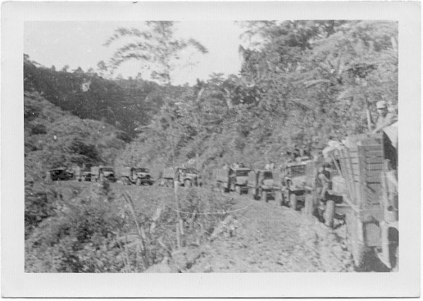
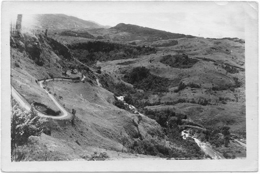
June 10-14Landed at Buga on North coast. Rode by trucks during day and slept by roadside at night - beautiful country - road very bad but it winds like a snake thru the mountains. Cold at nite. Passed thru Del Monte Plantation. Crawford - Owner.
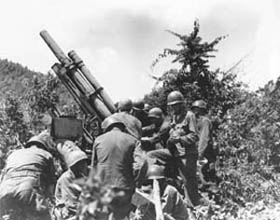
June 14, 1945You might call this the beginning of my combat experience. Yesterday we finally reached the rear echelon of Co. F. We slept in a tent and got rained out. I've been sleeping on the ground for about a month now. This morning I had my first hot meal in 3 weeks. After breakfast we began a hike that I will never forget. Partly because of the physical torture I endured and partly from seeing Jap corpses all along the way. We are fighting in the mountains about 13 mi. from Malabalay [Malaybalay]. The night of the 14 we dug in (4 of us to a hole) each fellow taking a two hour watch. The fellows were pretty trigger happy. Today I saw two dead Japs and a dead collaborator. Dr. Tom Deas confirms that this was near Silae, in the mountains due east of Malaybalay. He said, "F Company was part of Second Battalion and was the factor that cleaned out those Japanese in the Silae area." June 15, 1945Today we hiked as far as a field hospital over one of the worst mountain trails there are. In the valleys you go into mud up to your waist and the trail over the mountains are wet and slippery; so far we've carried packs and rifles. June 16, 1945Today we added a 4.2 [inch] mortar shell to our load. (28 lbs) We figured out that each guy was carrying 70 pounds now. My shoulders are raw from the pack straps. Going up the side of a mountain with such a load is just plain torture. You feel like your going to die from exaustion at any moment. 5 miles in these mountains is equivalent to a 20 mile hike with full field pack back in the states. Yesterday and today I saw dead Japs all along the way. Some were just bones, others just corpses by a few days. You can smell one coming up about 50 yards away. We've been drinking water from a fast flowing creek that is polluted by dead Japs. Today we waded knee deep in a swift mountain stream that nearly carried you away. (up stream.) My feet have been wet for 3 days now. I remember Dad telling me about this combat patrol. As the patrol hiked upstream, he and other new replacements drank from the stream, unaware that they would soon encounter the decomposing bodies of dead Japanese soldiers in the water. He described seeing maggots in the corpses and the skin peeling from their arms and hands. He also described the horrific realization of what was in the water he had been drinking. June 16 [second entry]We got to this place yesterday and have been resting all day. Our supplies are dropped by plane. A C-47 flies over every day and drops K rations. Ammo and Med supplies also dropped this way too. It's a damned queer feeling to be cut off from the rest of the world so completely. June 17Left the old Btn. hdqtrs. and head for F Co. which was on patrol in the mountains. Still have the mortar shells. Slept in an open field with a few dead Japs nearby. June 18Today we finally joined F Co. I'm now on one side of a river with the Japs on the other side. (just a swift stream). More physical endurance. Climbing the mountains. About noon a patrol brought in a Jap prisoner. They questioned him and then turned him over to the Guerillas. The Filipinos beat the hell out of him and then a couple of Replacements like myself shot him. I couldn't force myself to watch it and still feel like it was murder. However there was no possible way to get him back to a prison camp thru these mountains. After the boys pumped 30 slugs into him there wasn't much left of him. I feel that the guys that shot him did the wrong thing. They should have let the Filipinos finish him off. As I write now I'm in the dugout looking across the river. A few holes away on either side are 30 calibre heavies [.30 caliber heavy machine gun]. We're dug in in a perimeter the only defense ever used at nite over here. Anybody that gets out of his hole from dark to dawn is a Jap. You shoot first and ask questions later. (or heave out a grenade) Dad spoke of one soldier whose weapon was a Thompson Submachine Gun, who let him test fire the weapon. He described to me how the muzzle would rise up and to one side when firing a long burst. He later witnessed this soldier killing a Japanese POW with the weapon. It sickened him. June 19We were told that we were going back to Salay [Silae] to ambush 50 Japs. However when we got to Salay [Silae], we found that the Filipinos had taken care of the ones they found. June 20, 1945Today I was outpost guard on top of a high hill overlooking the Salay [Silae] valley. It's a former Jap observation post. Much to my surprise I found an old Catholic bell (Spanish) dated 1898. It had this inscription on it.
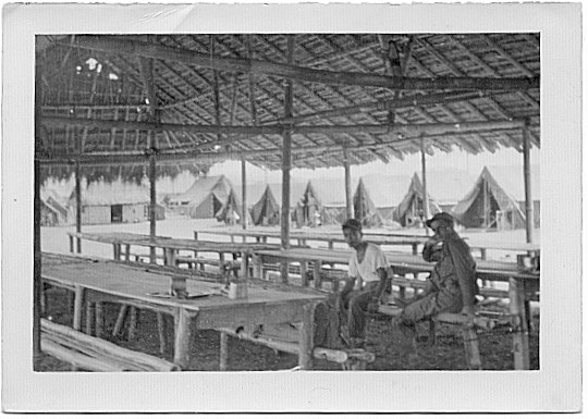
SAN YSIDOR LABRADOR Saint Isidor Labrador in the year 1898. How it was ever brought up into these mountains is beyond me. They say that years ago a missionary traveled thru here. My mother told me in May 2001 that Dad began smoking while in the Army in the Philippines. The Army provided cigarettes along with rations, and Dad told her that he sometimes smoked while on guard duty because "there was nothing else to do." He smoked cigarettes until 1953. June 21Today we marched back to the Palangy River. (where F Co. is located.) Again we carried a 4.2 mortar shell back with us - I was really tired out when we got back. ["Palangy" is crossed out and rewritten as "Pulangi." It is marked for pronunciation with the accent on the second syllable.] The Pulangi River is the name for northern reaches of the Mindanao River east of Malaybalay. Silae is located west from the Pulangi River up Silae Creek. June 22Just layed around today. G company crossed the Palangy [Pulangi] on a patrol. June 23Today I crossed the River and we took over G Companies old perimeter. Although we sleep in dugouts, everybody is using Nylon sheets and covers. 4 of us got a red nylon 24 foot parachute that is used to drop ammo and medical supplies. Food is dropped without a chute. Each chute costs better than $150 - $200. However there is no way to get them out of the mountains, so the boys tear them up and use them. June 24I went on a 6 man security patrol up the river. Found a couple dead Japs killed by maching [machine] gun fire yesterday. No living Japs seen. This afternoon we came back over the river on a rubber raft. June 25thBack to Salay! [Silae] We're finally going in. June 26thLayed around waiting C47 food drop. June 27thWent as far as hospital unit and supporting 105's. [105 mm howitzers] June 28thGot back to Malabalay [Malaybalay] at noon Thur. Had first hot meal. Here is photo of a 124th Infantry mess hall in Malaybalay (Paul Tillery). Hot chow is always a favorite of any army in the field. |
|||
Home | The Diary | Commentary | Credits | Links | Text Files |
|||
|
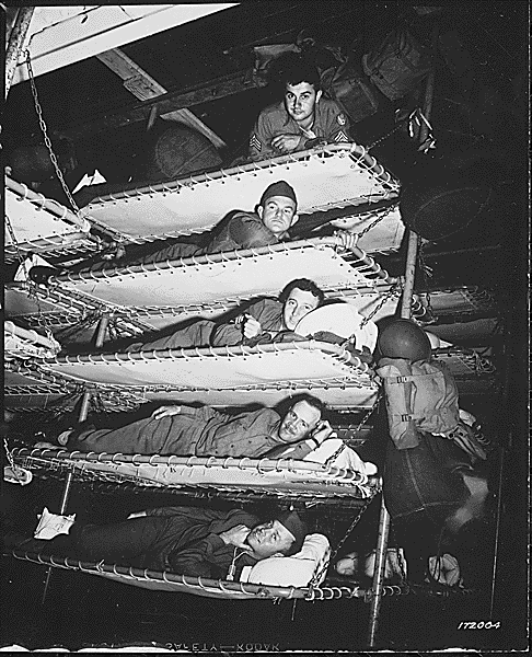
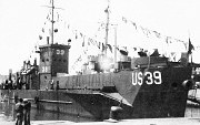
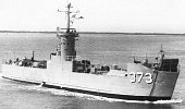
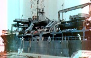 and we kept him alive feeding him Fig Newtons. Sanitation was almost
nil, and many of us developed strep throat." Right: A General Squier
class troop transport in
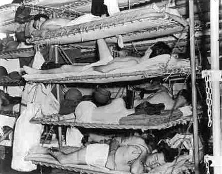
and we kept him alive feeding him Fig Newtons. Sanitation was almost
nil, and many of us developed strep throat." Right: A General Squier
class troop transport in

![4.2 [inch] mortar](images/42_mortar.jpg)